Okay, so this is probably unrelated to anything else on my blog except my curiosity (and that would make a good name for a blog — “My Curiosity”), but I discovered this website a while back, and I keep it open on my laptop screen and refresh it several times a day just to marvel.
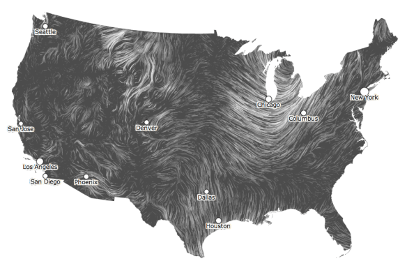
It’s a wind map of the continental U.S., that shows wind velocity and direction based on thousands of places that collect data. It takes a few seconds to load, and then you can see movement…
Here’s a snapshot of current wind data, and here’s a link to see it live:
Wind Map
Amazingly, this is a personal art project of two people who lead Google’s visualization group. You can check them out here. They’ve done a lot of other cool stuff.
There’s a gallery depicting wind patterns during Hurricane Sandy and at other times. You can see that the Midwest is very windy.
It reminds me of when I watched the weather report on television, and there were highs and lows. I’m no meteorologist, but I bet they influence wind patterns greatly.
